Satellite Images Reveal the Devastation of Manipur’s Conflict
New Delhi: From the sky, the scars of Manipur’s 20-month-long ethnic violence are unmistakable. Google Earth images depict the extent of destruction across the state’s most affected districts – Churachandpur, Kangpokpi, Bishnupur, and Imphal East. Entire villages appear to have been reduced to rubble, with trees growing in places where houses once stood.
Google Earth's pictures are based primarily on satellite imagery.
The violence, which began in May 2023, initially targeted Kukis in Imphal and Meiteis in Churachandpur. It has since evolved into a series of retaliatory attacks, creating a cycle of unrest that shows no signs of abating. Nearly 11,000 first information reports have been filed and close to 500 arrests made, but these figures only scratch the surface of the turmoil.
On the last day of 2024, Manipur chief minister N. Biren Singh expressed “regret” and issued an apology for the ethnic strife that has engulfed his state since May 3, 2023. Biren's role remains a matter of controversy and criticism. The conflict has claimed at least 250 lives and displaced nearly 60,000 people, forcing them into relief camps. The violence has deeply divided the region along ethnic and geographic lines, with the Kukis confined to the hills and the Meiteis to the plains. These unofficial borders have turned into perilous frontiers, where crossing over can have fatal consequences.
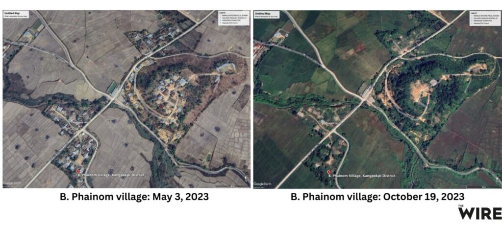
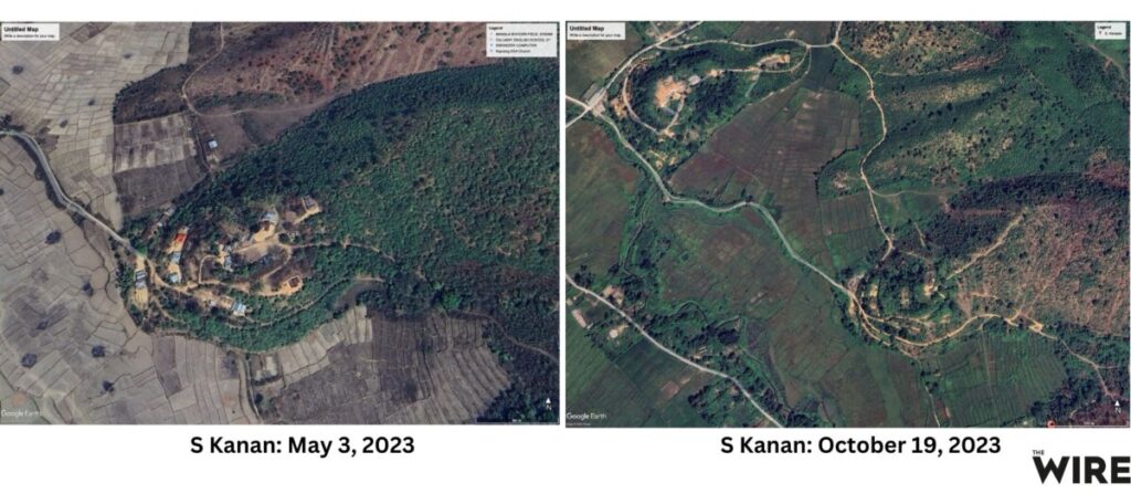
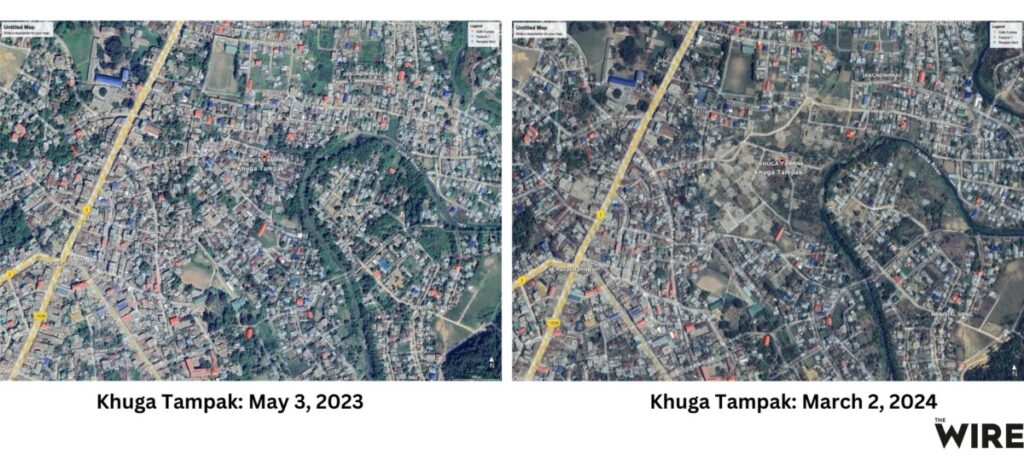
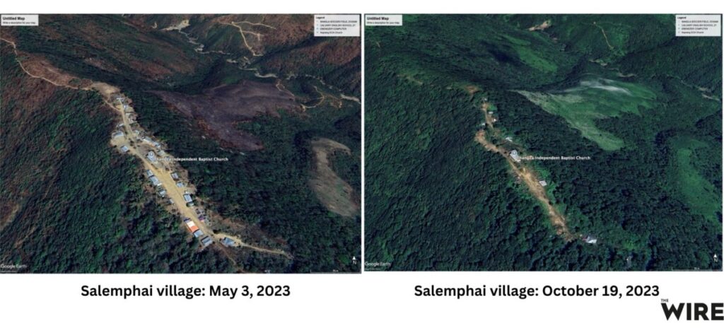
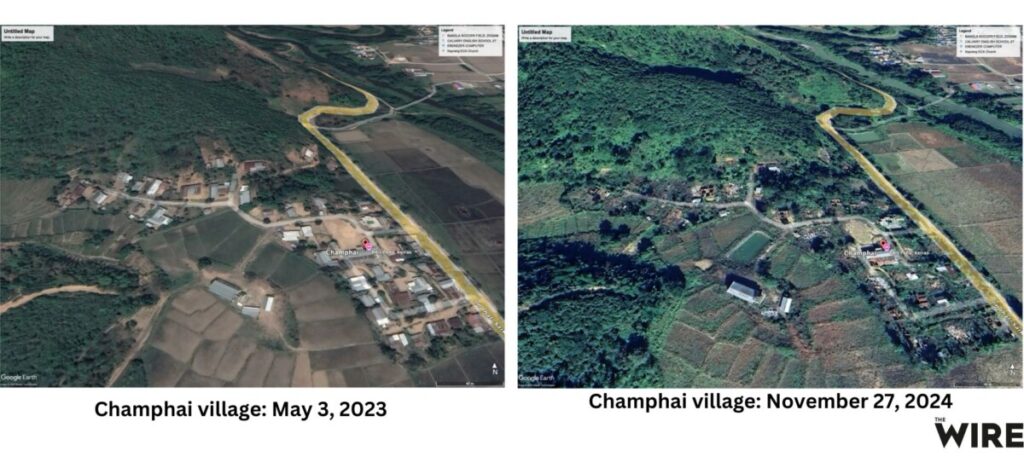
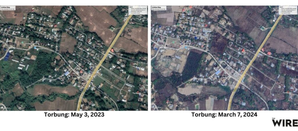
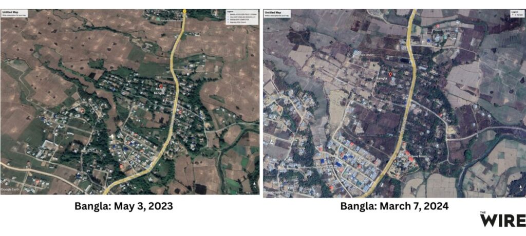
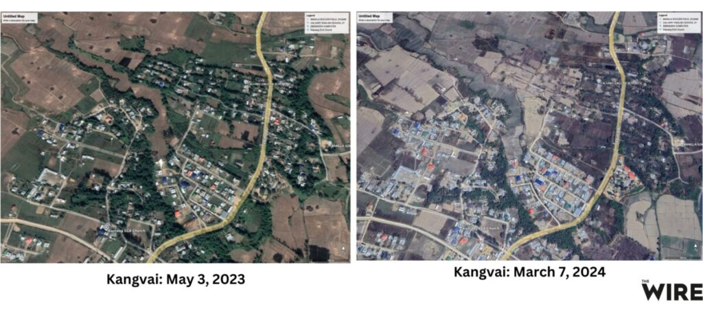
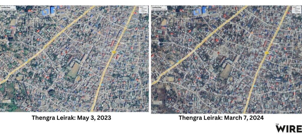
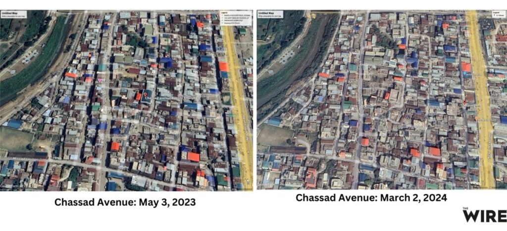
The following satellite images captured by The Wire reveal the full extent of the devastation. These images were captured in early 2025. The images on the left are those of the villages as they were on May 3, 2023 – the day the violence broke out. On the left are the villages as they were on the latest date at which the satellite images were available on Google Earth – this date is mentioned in each image.
B. Phainom village is where two Kuki women were paraded naked – seen in a video that sent ripples across the country. The village appears to have all but disappeared.
S Kanan village in Kangpokpi has also vanished from the map, with houses completely destroyed.
All houses belonging to the Meitei community at Khuga Tampak in Churachandpur were burnt down, locals told this reporter. Satellite images show a vast section of houses razed entirely.
Another village of Kangpokpi, Hankhongching, appears to have disappeared. Forests cover what used to be an entire village, including the church.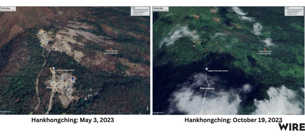
In Salemphai village in Kangpokpi, only the church remains, while the entire village has been burnt to ashes.
Champhai village on the Imphal-Saikul highway appears half destroyed.
Imphal, the capital city, is dominated by the Meitei community, while the Kuki community inhabits other areas. To reach the Kuki-dominated Churachandpur, one must pass through Torbung in Bishnupur district. Before the violence, both communities lived in Torbung, making it difficult to distinguish which houses belonged to whom. However, during this reporter's visits, he observed that the houses of the Meitei community along the highway had been burnt.
People from both the Meitei and Kuki communities lived in the Bangla area of Churachandpur. Many houses have been burnt there as well, making it difficult to say whether only houses of one community were affected.
The first village of Churachandpur is Kangwai, where 90% of the people belong to the Kuki community. Before the violence, there were some houses belonging to the Meitei community as well. Therefore, it can be said that the burnt houses may belong to both the communities.
The homes of 1,300 Meitei families were destroyed in the violence at Khumujamba Meitei Leikai in Churachandpur. It is said that all Meitei houses were bulldozed:

Thengra Leirak, an area where the Meitei community resides, saw almost all of its houses burned down, according to locals, forcing the entire community to flee to Imphal Valley for survival.
Chassad Avenue and New Lambulane in the heart of Imphal were once home to the Kuki community. But when violence erupted, they were forced to flee to Kangpokpi and Churachandpur, leaving behind homes that would later be engulfed in flames.
The Wire is now on WhatsApp. Follow our channel for sharp analysis and opinions on the latest developments.


