
Clouds From Equator Will Affect Monsoon Rains in Unexpected Ways
Bengaluru: The Indian landmass and its adjoining seas, including the Bay of Bengal and the Arabian Sea, will face higher rainfall during wet monsoon spells in the coming decades leading up to 2100. Two scientists from the Centre for Atmospheric and Oceanic Sciences (CAOS), Indian Institute of Science (IISc) predicted this while studying mathematical models of the global climate, which indicate that the average temperature will increase somewhere between 2° and 4° Celsius.
Since the 1980s, climate scientists studying the relationship between global wind and ocean current patterns have known that clouds over the equatorial waters, when triggered by atmospheric disturbances, move northwards and cause wet spells over the Indian peninsula. The new paper, published in npj climate and atmospheric science on February 28, 2025, however, claimed that only those disturbances stronger than a threshold can cause the necessary northwards movement. Despite the expectation that the amount of monsoon rainfall might decrease due to this, the same researchers found that, on average, the rainfall will have more intense spells in the coming decades, interspersed by dry periods.
However, independent researchers question the exact predictions and warn they need a more thorough understanding.
Northward movement depends on equatorial changes
Since 2004, researchers have known that winds from the equator affect the monsoon rains over the tropics. Moreover, when it rains over the equators, it is dry over the tropical area over which the monsoon is situated, and vice versa. Atmospheric instabilities over the equatorial seas – sometimes as wide as thousand kilometres over the equatorial seas – cause these cyclical patterns of wet and dry spells. Scientists study the movement of clouds from the equator to the tropics to deduce the pattern of rains over the peninsula and its adjoining seas.
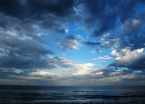
A sunset view from a beach in Tamil Nadu, India of monsoon clouds over the Bay of Bengal. Photo: Flickr/mmj171188 (Creative Commons Attribution-Share Alike 2.0 Generic)
Recent studies have shown that climate change brings in more extreme rainfall events over India, but exact predictions become complicated because of more frequent changes within the same season. These are the El Niño-Southern Oscillation (ENSO), the Indian Ocean Dipole (IOD), and the Pacific Decadal Oscillation (PDO) – which are sea-surface and adjoining temperature fluctuations across different parts of the Pacific and Indian Oceans.
The dynamics of the atmosphere and their interactions with oceanic processes can either enhance or suppress extreme rainfall activity. So, Kottapalli and Vinayachandran studied these interactions with the help of climate models and detailed computer simulations of the exact equations governing them.
First, they confirmed that due to climate change, the atmosphere is becoming warmer. Second, they found that extreme rainfall events will increase over the next decades because a warmer atmosphere will contain more moisture.
However, what surprised the IISc team is that not all clouds from the equator will travel northward and cause rainfall. Rather, “the strength of equatorial convection determines whether a cloud band would propagate northward or not,” said Aditya Kottapalli, one of the study’s authors.
The researchers concluded that the rainfall over the landmass, the Arabian Sea, and the Bay of Bengal will increase significantly, between 42 and 63%, at the peak of the monsoon. That’s a significant change, considering the monsoon rains are related to the lives, crops, and livelihoods of Indians – and excess rainfall often wreaks havoc.
Experts advise caution
Independent scientists who were not involved in the study agreed with some of its findings.
“I… agree that extreme rain events are likely to intensify,” said Roxy Mathew Koll, a researcher at the Indian Institute of Tropical Meteorology, Pune, who was not involved in the study. On its own, the trend of extreme rainfall events is expected, confirmed other scientists also not involved in the study.
However, all independent researchers The Wire spoke to advised caution in interpreting the IISc team’s results. Two researchers who do not wish to be named said that the study’s authors have not evaluated the range of uncertainties of these numbers. As Kottapalli admitted, there are causes for uncertainty in these estimates, and the devil lies in the details.
Climate models predict that the moisture available over the Indian landmass and the adjoining areas in the wet spells will increase significantly. By itself, that does not mean the rainfall will increase by the same amount. Kottapalli agreed before adding that the rains might even increase more than the increase in moisture content in the atmosphere. That’s because other disturbances – whose origins are not clear yet – can bring in more rain. Kottapalli hinted that rainfall areas could attract moist winds from nearby areas, causing more rain.

Early morning on whaling coast, Bahia, Brazil. Photo: Jonathan Wilkins/ Wikipedia.
Koll warned that earlier studies have shown that there are other phenomena at play when it comes to moisture and rainfall over the Indian landmass and the adjoining seas, especially the Indian Ocean, which is warming faster than the landmass. One of the phenomena, called ‘dynamical suppression’, limits how much the monsoon winds reach the landmass. “As a result, rainfall over central and northern India has been on the decline,” he said, adding: “This aspect is missing from the current study.”
Kottapalli agreed that northward propagation of the clouds from the equator could weaken after they cross the monsoon zone above 25° N latitudes.
“Our preliminary analyses suggest that the dynamical suppression will dominate until the 2050s,” said Koll. But, he agreed that afterwards, the effects the IIsc team have studied may start to take over. The team’s predictions stretch till the 2100s.
Kottapalli said studying the equatorial and tropical wind and cloud patterns will be crucial in predicting the weather. “Once we have a better prediction in place, we can warn the people and farmers about the impending wet spell that is coming and enhance the preparedness,” he said. “This also applies to prolonged dry spells, which could lead to droughts and prepare the authorities for taking food security measures.”
Weather monitoring over the next decade will not only help understand the pace of rainfall increase but also help climate scientists predict such extreme fluctuations.
Debdutta Paul is a freelance science journalist.
This article went live on April thirteenth, two thousand twenty five, at twenty-five minutes past ten in the morning.The Wire is now on WhatsApp. Follow our channel for sharp analysis and opinions on the latest developments.


