
UNCLOS, an American Ship and India's Maritime Boundary
Earlier this month, the US announced that a warship of theirs, the John Paul Jones had sailed 130 nautical miles west of the Lakshadweep islands, within India’s Exclusive Economic Zone (EEZ) without India’s prior consent.
This was what the US terms a Freedom of Navigation Operation (FONOPS) aimed at challenging states like India who they say have gone beyond the provisions of the United Nations Convention on the Law of the Seas (UNCLOS) to assert “excessive” maritime claims.
Indians were rightly upset by this. Former navy chief Admiral Arun Prakash termed it an “act of breathtaking inanity” considering the atmosphere of rapidly warming Indo-US ties and “within weeks of the US-led Quad leaders virtual meetings and on the heels of a major Indo-US naval exercise”.
Though this generated many headlines, this was certainly not the first time this has happened. By its own count , the US has conducted such operations in Indian waters 19 times in the past 30 or so years since 1991. The only difference is, that for reasons best known to itself, the US decided to immediately publicise it. Usually, such operations around the world, affecting various countries, would form a long list which would be issued by the US Department of Defence annually.
While countries like India which are close to the US are baffled, those like China see a sinister motive behind this. They say the US uses the provisions in UNCLOS that do not explicitly prohibit military activity in its Exclusive Economic Zone to keep a close deployment off China’s coast. The US has, famously, used FONOPS to challenge Beijing’s over-the-top maritime claims in the South China Sea where a UNCLOS tribunal has ruled Chinese artificial islands do not merit the maritime claims Beijing is making.
Also read: How Long Will New Delhi Let Washington Do as it Pleases?
There is also a benign explanation for this is. The US has not ratified the UNCLOS, but says it observes it as customary international law. One of its principles, as a Belfer Center explainer notes, is the US does this is to prevent the law itself from changing over time. According to the explainer, “states must persistently object to actions by other states that seek to change those rules.” As a maritime power, it is usually the US which ends up sailing into other state’s territorial waters or conducting military activity in their Exclusive Economic Zone. So, it needs to ensure that the current rules stay.
Under UNCLOS, states have the right to conduct military manoeuvres and movements within the 200 nm EEZ of a state. Indeed, they have the right of “innocent passage” where they can come into the territorial waters within just 12 nm of the country, if they sail straight through without turning on their weapons-related sensors.
At the time of signing and ratifying the UNCLOS, India had made a declaration that in its view, the Convention does not authorise other states to carry out “military exercises or manoeuvres… without the consent of the coastal state.” Later this was incorporated into domestic legislation.
But this was merely an expression of India’s “understanding” of the spirit of UNCLOS, not its letter. The US says it conducts FONOPS to challenge the claims in excess to those provided by the letter of the treaty.
So, the US has for the past 30 years challenged India’s claim that you need to notify us before you conduct military manoeuvres in our EEZ. We have been able to live with it; indeed, short of taking on the US Navy, we had little alternative.
But there is another problem in the Lakshadweep islands. They are some 200 nautical miles from the Kerala coast which puts them at the edge of the EEZ. But because of them, we can extend the EEZ another 200 nm or so out to a part of the high seas which have huge strategic importance. This is the Nine-Degree Channel through which a vast amount of shipping goes.
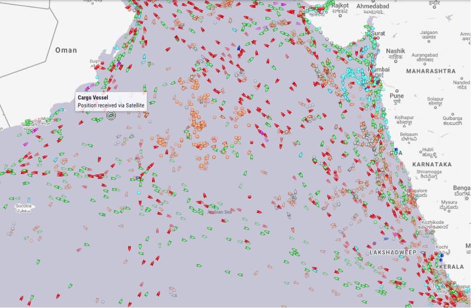
Lakshadweep’s strategic location. Photo: marinetraffic.com as of April 16, 2021
Maritime boundaries follow a simple principle. Twelve nautical miles out from your shore are territorial waters where the laws of the land are in force. Some laws can be applied for the next 24 nm of waters called the contiguous zone. Thereafter comes another 200 nm of what is called the Exclusive Economic Zone, which are technically the high seas where your laws do not hold, only that you have the right to exploit its fisheries and seabed resources.
Maritime boundaries lead off from what is called a baseline point on your shore – it is the low-tide point from which the count 12+24+200nm outward to the sea is measured. So, usually, your territorial waters, contiguous zone and EEZ mimic your land boundary.
Islands like the Lakshadweep and Andaman and Nicobar also follow the same principle of 12+24+200; in addition, if there are outlying rocks, they generate contiguous zones of 24 nm (and low tide elevations fetch nothing).
Now in an option given to archipelagic states like Indonesia, Fiji and the Philippines, instead of landing up with a polka dot pattern maritime boundary, they are allowed to define a boundary by creating straight baselines by joining the baseline points of their outermost rocks/islands and enclosing the area within as their internal sea.
In Lakshadweep, India has, through a 2009 notification, claimed a boundary using straight baselines drawn with nine or so baseline turning points, though this is a provision not available to India or any other continental state till now under the UNCLOS. So far, barring Pakistan, no one has protested this move. And though the USS John Paul Jones was 130 nm away from the Lakshadweep, there is no indication that the 2009 Indian straight baseline claim was challenged. In fact, there is no indicator in a check list of the US State Department whether Lakshadweep is on their target list. But they do have issues with the Indian claims in the Gulf of Mannar and the Palk Bay.
At the end of the day, challenges close to India’s shores are likely to come only from states which have the ability to mount it. So far, there is only the US which can do it. But China is rising and there are worries that it may take the path of the US. That would be ironic, since China itself has drawn straight baselines around the Paracel Islands which the US has challenged by sending a ship through them. But in power politics, you should be prepared for all kinds of surprises.
Manoj Joshi is a Distinguished Fellow, Observer Research Foundation, New Delhi.
This article went live on April nineteenth, two thousand twenty one, at fifteen minutes past five in the evening.The Wire is now on WhatsApp. Follow our channel for sharp analysis and opinions on the latest developments.


