
ISRO Successfully Launches Remote Sensing Satellite
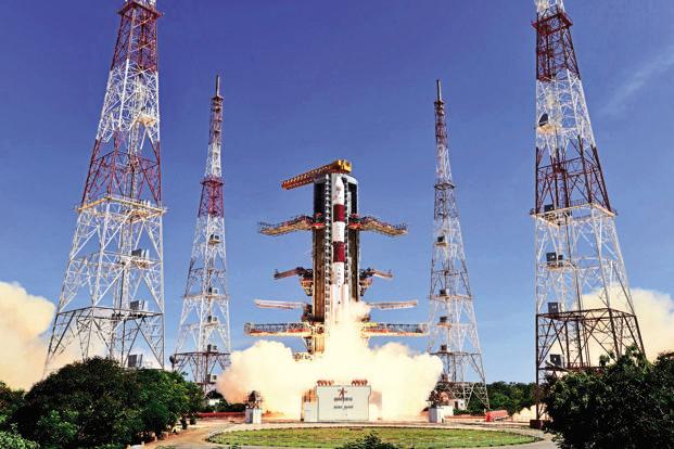

The satellite was earlier planned for launch on November 28. Credit: ISRO
Bengaluru: India today successfully launched its latest remote sensing satellite, RESOURCESAT-2A, which would be useful for agricultural applications like crop area and production estimation, drought monitoring, soil mapping, cropping system analysis and farm advisories generation.
In a flawless mission, Indian Space Research Organisation's (ISRO) workhorse Polar Satellite Launch Vehicle PSLV-C36 blasted off at 10:25 a.m. from the spaceport at Sriharikota in Andhra Pradesh and injected the satellite into orbit after a flight of 17 minutes and five seconds.
"It has been a perfect launch," ISRO Chairman Kiran Kumar said.
The satellite, once brought to its final operational configuration, will begin to provide imagery from its three cameras and the data will be useful for agricultural applications.
The 1,235-kg RESOURCESAT-2A is a follow-on mission to RESOURCESAT-1 and RESOURCESAT-2, launched in 2003 and 2011 respectively.
It is intended to continue the remote sensing data services to global users provided by RESOURCESAT-1 and 2.
ISRO said PSLV-C36, the 38th flight of PSLV, blasted off from the First Launch Pad at Satish Dhawan Space Centre with the ignition of the first stage.
Then the subsequent important flight events, namely strap on ignitions and separations, first stage separation, second stage ignition, payload fairing separation, second stage separation, third stage ignition and separation, fourth stage ignition and cut-off, took place as planned, ISRO said.
After a flight of 17 minutes and five seconds, the vehicle achieved a polar sun-synchronous orbit of 824 km height inclined at an angle of 98.725 degrees to the equator (very close to the intended orbit) and 47 seconds later, RESOURCESAT-2A was separated from the PSLV fourth stage.
After separation, the two solar arrays of RESOURCESAT-2A deployed automatically and ISRO's Telemetry, Tracking and Command Network (ISTRAC) here, took over the control of the satellite.
ISRO said in the coming days, the satellite will be brought to its final operational configuration, following which it will begin to provide imagery from its three cameras.
Kumar said the satellite is going to provide continuity to "our three tier imaging data, which will be extremely useful for various applications of land and water."
"I wish to congratulate the entire ISRO team for the wonderful job they have done and for putting one more operational satellite into orbit," Kumar said.
ISRO said that data sent by RESOURCESAT-2A would be useful for agricultural applications like crop area and crop production estimation, drought monitoring, soil mapping, cropping system analysis and farm advisories generation.
The mission life of RESOURCESAT-2A is five years.
The satellite was earlier planned for launch on November 28.
ISRO said like its predecessors RESOURCESAT-1 and 2, RESOURCESAT-2A has a unique 3-tier imaging system with Advanced Wide Field Sensor (AWiFS), Linear Imaging Self Scanner-3 (LISS-3) and Linear Imaging Self Scanner-4 (LISS-4) cameras.
AWiFS provides images with a sampling of 56 metres, a swath of 740 km and a revisit of five days whereas the LISS-3 provides 23.5 metre sampled images with 141 km swath and a repeativity of 24 days, it said
LISS-4 provides 5.8 metre sampled images with 70 km swath and a revisit of five days.
RESOURCESAT-2A also carries two solid state recorders with a capacity of 200 giga bits each to store images taken by its cameras, which can be read out later to ground stations.
In this flight, the 'XL' version of PSLV with six solid strap-on motors was used.
The total number of satellites launched by PSLV, including today's RESOURCESAT-2A has now reached 122, of which 43 are Indian and the remaining 79 are from abroad.
This article went live on December seventh, two thousand sixteen, at twelve minutes past four in the afternoon.The Wire is now on WhatsApp. Follow our channel for sharp analysis and opinions on the latest developments.


